Search results for: “Apple Maps”

  • Apple Maps gets a handy new feature and a travel wish

    Apple Maps gets a handy new feature and a travel wish

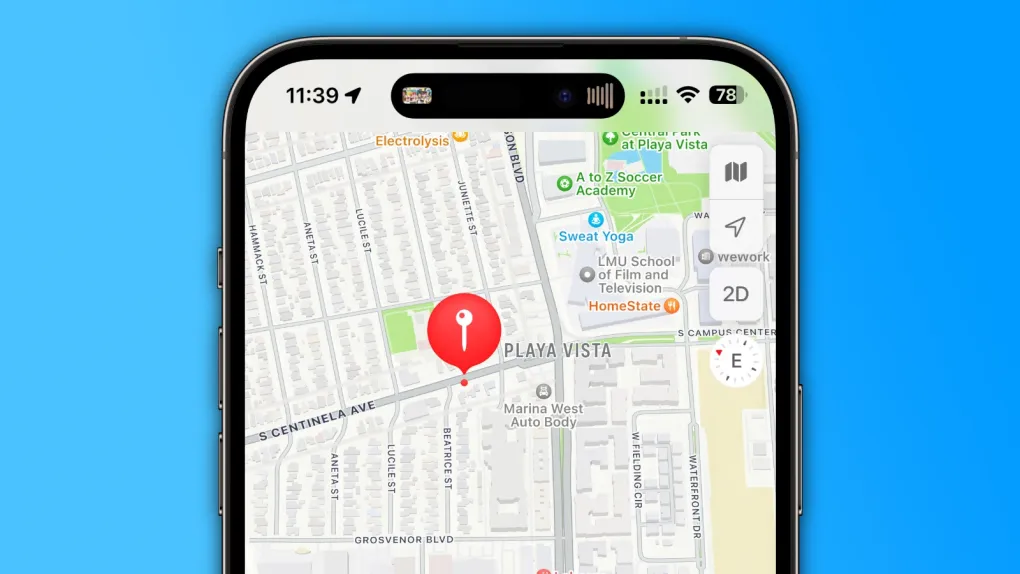
    Apple Maps has added a cool feature that feels like it came straight from the Notes app. Now, you can create custom guides to plan trips or save your favorite spots. These guides let you add personal notes, like tips about a great café or a scenic park, and pin them to specific locations.

    It’s super easy to organize your ideas, whether you’re exploring a new city or keeping track of places you love. This makes Apple Maps more personal and helpful, turning it into a tool for both navigation and memory-keeping.

    On another note, there’s a big wish for Apple to make international travel simpler with eSIMs. Right now, getting a local data plan abroad can be a hassle—think long lines or tricky apps. Imagine if your iPhone could instantly connect to a local network when you land, with Apple Maps offering cheap eSIM options right in the app.

    You’d pick a plan, activate it, and stay connected without stress. This would be a game-changer for travelers, saving time and avoiding pricey roaming fees. While it’s just an idea for now, it shows how Apple could make exploring the world easier.

  • Apple Maps highlights indigenous areas in Australia and New Zealand

    Apple Maps highlights indigenous areas in Australia and New Zealand

    Starting today, Apple Maps on iPhones, iPads, and Macs shows Indigenous lands in Australia and New Zealand, like reserves and special protected spots. This update helps people see and learn about these important places easily.

    Apple worked with Indigenous communities, map experts, and language keepers to make this happen. In Australia, they used information from the Australian Institute of Aboriginal and Torres Strait Islander Studies. In New Zealand, they teamed up with Māori tribes and local mapmakers to create detailed info cards and symbols for these lands.

    These cards share facts about the areas, and locals can add their own photos, stories, and words in their native languages. No extra app update is needed—the new features are ready to use now. This change shows Apple’s effort to connect with communities and respect their history. They’ve also started projects in both countries to support education and protect nature, making a bigger difference beyond just maps.

    Want to know more? Apple’s official statement has all the details about these updates and their community work. With this step, Apple Maps becomes more than just a navigation tool—it’s a way to honor and explore the rich cultures of Australia and New Zealand’s Indigenous peoples.

  • Apple Maps cars now snapping pics to boost AI skills

    Apple Maps cars now snapping pics to boost AI skills

    Apple is giving its Apple Maps cars a new job. These vehicles, already known for capturing street views with their “Look Around” feature, will now also take photos to help improve Apple’s smart technology. The goal? To make Apple Intelligence models sharper and better at understanding the world.

    For years, these cars have roamed streets, snapping detailed images to create a 3D-like view for Maps users. Now, Apple wants to use those same pictures to train its artificial intelligence. This AI powers things like Siri and other clever tools, helping them learn how to spot objects, places, and patterns in real life.

    The company says it’s all about making its tech smarter while keeping things private. The photos won’t show people’s faces or license plates—Apple blurs those out to protect privacy. Plus, the images stay focused on public spaces, not private homes or backyards.

    Apple’s move isn’t brand new. Other tech giants, like Google, have long used street pics to teach their AI. But Apple’s stepping up its game, blending Maps data with its push into smarter, more helpful devices. The cars will keep cruising cities worldwide, quietly gathering shots to fuel this tech upgrade. So, next time you see an Apple Maps car rolling by, know it’s not just mapping your street—it’s helping build a brainier future for your iPhone, too.

  • Apple Maps glitch confuses airport travelers

    Apple Maps glitch confuses airport travelers

    A strange problem popped up in Apple Maps recently, messing with travelers at airports. On March 23, 2025, users noticed that the app was showing wrong directions to baggage claim areas. Instead of guiding people to pick up their luggage, it sent them to random spots like parking lots or even outside the airport entirely.

    This mix-up caused a lot of frustration. People shared their confusion online, with some saying they wandered around for ages before finding their bags. The glitch didn’t hit every airport, but it affected enough to catch attention. Experts think it might be a glitch in how Apple Maps labels indoor spaces, like terminals.

    Apple hasn’t said much yet, but they’re likely working on a fix. For now, travelers should double-check signs at the airport or ask staff for help, just to be safe. This isn’t the first time a map app has tripped up, and it probably won’t be the last. Still, it’s a reminder that tech isn’t perfect—sometimes you’ve got to trust your own eyes over your phone.

  • Apple silently releases a new app to boost Apple Maps

    Apple silently releases a new app to boost Apple Maps

    Apple recently rolled out a fresh app called “Maps Surveyor” on Friday, designed for people eager to help make Apple Maps better. This app lets users gather info about their local areas—like snapping pictures—and send it straight to Apple. But it’s not open to everyone just yet.

    What’s the Deal with Maps Surveyor?

    The app’s description says, “Surveyor assists Apple in upgrading Maps by grabbing details like street sign photos and roadside sights while following a set path.” It’s free to download from the App Store, but it looks like Apple made it for a select group of users.

    Once you install it, the app asks you to open another app called Premise. This platform pays people small rewards for doing easy tasks, like answering questions, sharing personal details, or taking pictures of certain spots. In short, it’s a place where users earn cash for helping out.

    According to MacRumors, hints in the app’s code show that Apple plans to team up with Premise to invite folks to improve Maps and get rewards in return. Users will need to attach their iPhone to a mount sideways and use Maps Surveyor to snap photos along a planned route.

    A Quiet Start

    The list of companies that provide data for Apple Maps doesn’t include this new app yet—maybe because it’s brand new. Apple already uses its own cars to drive around cities worldwide, collecting info to polish up Maps. The Surveyor app seems like an extra way to get help from everyday users.

    Right now, Maps Surveyor is only available in the United States. If you’ve got an Apple device and want to pitch in, you can still use the “Report an Issue” feature in Apple Maps to share your thoughts with the team. This quiet launch shows Apple’s ongoing effort to make its mapping tool sharper and more reliable, one photo at a time!

  • Ford drivers can now use Tesla chargers with Apple Maps

    Ford drivers can now use Tesla chargers with Apple Maps

    Ford has exciting news for Mustang Mach-E and F-150 Lightning owners! If you use Apple Maps EV Routing through CarPlay, you can now find routes that include Tesla Superchargers and other chargers using the North American Charging Standard (NACS). This update makes charging on the go even easier.

    Before this change, Apple Maps EV Routing didn’t include Tesla’s Superchargers. Now, Ford drivers can enjoy this perk without needing a software update. All you need is an iPhone running iOS 17 or higher connected to CarPlay. To make it work, go to Apple Maps Settings and choose NACS chargers as your preferred network. You’ll also need a Fast Charging Adapter that works with NACS stations.

    Apple launched its EV Routing feature in 2023 to help electric vehicle drivers plan trips. However, it’s only available for a few models, like the Ford Mustang Mach-E, Ford F-150 Lightning, and Porsche Taycan. Car companies must add support for it to function with their vehicles.

    This handy tool uses real-time info from your car to suggest the best route. It looks at things like hills on the road and your battery level to decide when you’ll need to stop and charge. If your battery runs low, Apple Maps will guide you to the closest compatible charger, so you’re never stuck.

    People first noticed hints of NACS support in iOS 18.4, but Ford says you don’t need to wait for that update. Apple made this change remotely, so it’s ready to use right now. With this update, Ford drivers can hit the road with more confidence, knowing they’ve got access to Tesla’s charging network alongside other options.

  • Easier bike route planning with Apple Maps in the UK and Ireland

    Easier bike route planning with Apple Maps in the UK and Ireland

    Apple Maps has just made it easier for bike riders in the UK and Ireland to find their way around. A recent update spotted by a user on Reddit means that now, you can plan a bike trip from one end of the country to the other, like from the southern tip of England to the northernmost part of Scotland, if you feel like it.

    Before this update, the bike route feature wasn’t available everywhere in these countries. Now, Apple Maps gives you specific paths for cyclists, showing you where the bike lanes are, which paths are good for bikes, and warning you about steep hills, stairs, or other things that might get in your way.

    This feature has been part of Apple Maps since the iOS 14 update, and it’s not just in the UK and Ireland. Cyclists in the United States, Australia, China, France, Germany, and Japan, along with big cities like London, Barcelona, and Toronto, can also use it. Apple keeps an updated list on their website of all the places where this cycling feature works.

    This expansion is great news for anyone who loves to bike or just needs to get around on two wheels, making your journey safer and more enjoyable.

    Cycling Directions Released in Remainder of UK and Ireland
    byu/cmmncw inapplemaps

  • Apple Maps to add Tesla supercharger locations for Ford EV users

    Apple Maps to add Tesla supercharger locations for Ford EV users

    Apple Maps is getting a big update that will make planning trips easier for people driving Ford Mustang Mach-Es and F-150 Lightnings.

    The Apple Maps feature for electric vehicles (EVs) helps you plan your journey by adding stops for charging when you need them. It keeps track of your car’s battery and looks at things like how fast you’re driving, how high the road goes, and how quick the chargers are to figure out when you should charge and for how long.

    Right now, this feature only works with three cars: the Ford Mustang Mach-E, the Ford F-150 Lightning, and the Porsche Taycan. Last year, Ford started sending out adapters to let these Ford cars use Tesla’s Superchargers. These cars have a CCS charging port, and the adapter changes it to work with Tesla’s NACS plug.

    However, Apple Maps hasn’t known about this yet. It only shows you where to go for CCS stations. But, that’s going to change. Ford’s lead engineer for the Mustang Mach-E, Donna Dickson, mentioned in a forum post that the system will soon know about these changes.

    Soon, you’ll be able to see where compatible Tesla Superchargers are right from the navigation in the new 2025 Mustang Mach-E. These locations are already visible on Google Maps for Android Auto users and will soon appear on Apple Maps for those using Apple CarPlay.

    There aren’t a lot of details yet on how this will all work, but it’s expected that Ford drivers with the NACS adapter can tell Apple Maps they can use both CCS and NACS stations. This will help Apple Maps give better, more accurate advice on where to charge.

    As a Mustang Mach-E driver, I’m excited about this update. I hope Ford and Apple will share more soon.

    If you own an electric car, consider charging it at home with solar panels on your roof. To find a good solar installer, check out EnergySage. It’s a free service where you can get personalized solar quotes, compare them online, and get advice from Energy Advisers. This way, you can save money and make sure you’re getting a quality setup without the hassle of sales calls until you’re ready.

  • Apple adds expert reviews to Maps, Music transfer tool, and smarter Calendars

    Apple adds expert reviews to Maps, Music transfer tool, and smarter Calendars

    Apple just rolled out a few new updates across its apps that aim to make your experience better and more helpful.

    First, Apple Maps is getting more reliable. It now includes expert-sourced information in its place cards—those little cards you see when you tap on a location. Instead of just showing reviews from users, Apple has teamed up with travel pros like Lonely Planet, The Infatuation, and others. These expert tips help you discover good places to eat, fun spots to visit, and hidden gems in cities like New York, London, and Paris. More cities will be added soon.

    Next up, Apple Music is making it easier to switch from other music apps. A new feature lets users import their playlists and libraries from services like Spotify, YouTube Music, and Amazon Music straight into Apple Music. This means you won’t lose your favorite songs if you switch. Apple is using a tool made by SongShift to make this happen, and it’s built into the Apple Music app.

    Lastly, Apple’s Calendar app is quietly getting smarter. It now shows a daily task list—things you’ve added to your Reminders app—right in your calendar. This makes it easier to stay on top of your day. The feature is great, but one small thing could make it even better: letting users choose which reminders appear. Right now, it shows all of them, even the ones that aren’t tied to a specific time.

    These updates show how Apple is making its apps more useful and connected.

  • Apple adds Formula 1 race previews to Maps for a fun, interactive experience

    Apple adds Formula 1 race previews to Maps for a fun, interactive experience

    Apple Maps is adding a new Formula 1 feature for fans to explore race tracks in a fun and interactive way. Starting with the Miami Grand Prix, users can experience a 3D version of the track using the “Explore” feature on iPhone, iPad, and Mac.

    With this feature, users can get a closer look at the track layout, see key points like turns and pit lanes, and view nearby spots for parking, food, and hotels. It’s similar to Apple’s Look Around view, but designed specifically for Formula 1 events.

    This new update is part of Apple’s growing partnership with Formula 1. Apple TV+ is also working on a new F1 movie starring Brad Pitt, which is expected to come out soon. In addition, Apple Music created a special playlist for the Miami Grand Prix and shared the playlist from F1 driver Charles Leclerc.

    Apple hasn’t said if this 3D Maps feature will be available for all races, but we’ll likely see it added for other major events later this year. This could make following the sport more exciting for fans and easier for visitors attending in person.

    The F1 Maps feature is now live for the Miami race and will work on devices with the latest Apple software. Users just need to search for the Miami Grand Prix in Apple Maps and tap “Explore” to check it out.